Enabling children and young people to participate in cutting-edge urban forest research.
Map the green
It’s becoming even more important than ever to protect the green spaces that future generations so desperately deserve. But to do this effectively, we, and future generations need to understand them. This new science, technology, engineering and mathematics (STEM) project aims to do just that. Find out how below.

Do you want to stay up to date?
Then sign up to our newsletter for the latest news, insights and research.
Then sign up to our newsletter for the latest news, insights and research.
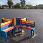
Image Source: Malcolm Cochrane
How it works
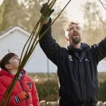
Bringing together leading academics and education partners with children and young people, this project aims to contribute valuable data to an innovative new Europe-wide (and possibly global) research project. Together, the project participants will use satellite, above ground and terrestrial LiDAR data to identify and map urban forests both in the UK and overseas.
Through the project, participating pupils, their schools and communities will gain a better understanding of the environmental and social values of their neighbourhood trees. We hope that their work will advance our shared knowledge for the benefit of all.